


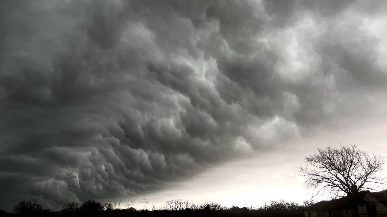
The atmospheric setup this evening is supportive of the development of strong and severe storms across parts of Texas including DFW, Austin, San Antonio, and much of the Hill Country.
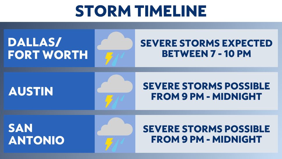
Storms will be possible starting early evening, and the threat will not be entirely diminished until after midnight. Exact timing and threats will differ depending on location.
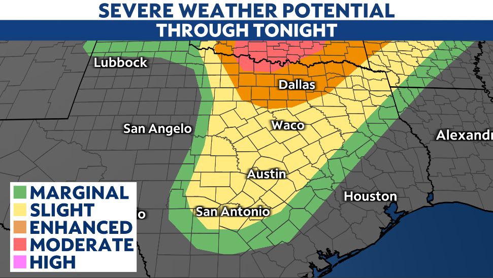
As of Monday afternoon, the Storm Prediction Center (SPC) has upgraded the severe thunderstorm risk for much of Texas. Dallas/Fort Worth is under an enhanced risk, while Austin and San Antonio have been put under a slight risk. There is a moderate risk area (level 4 out of 5) for areas along the Red River between Gainesville and Wichita Falls.
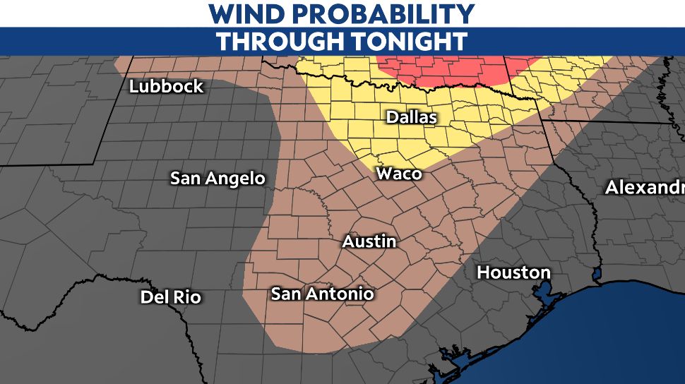
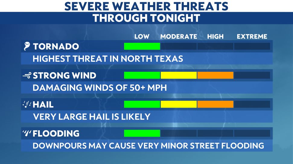
For Dallas/Fort Worth, Austin, and San Antonio, the primary threats associated with storms that will develop tonight are damaging wind gusts and very large hail. Hail may be golfball-sized or larger, and wind gusts could easily exceed 50 miles per hour.
Cars should be moved to a garage or sheltered area, and any outdoor furniture or large items should be properly secured. Pets and livestock should also have sufficient shelter, as large hail can injur those who are left outdoors.
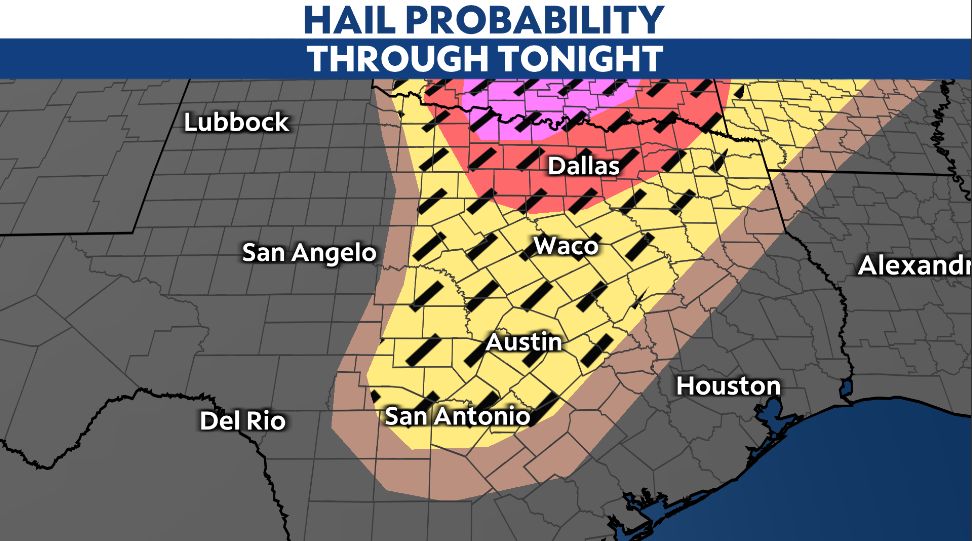
For both hail and wind, the threat for DFW is higher than that of Austin and San Antonio.
While it is not the chief concern tonight, a small tornado threat does exist for DFW, Austin, and San Antonio. Tornadoes will be more likely before nightfall, as instability will feed potential tornadic activity.
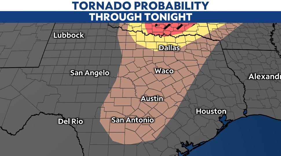
Much like the hail and wind threat, the tornado threat is highest for DFW and areas to the north of the metroplex/along the Red River.
Given that all modes of severe weather are possible, it is imperative that you have multiple ways to receive weather alerts. Furthermore, always have a plan to take action when a warning is issued.
Our team of meteorologists dives deep into the science of weather and breaks down timely weather data and information. To view more weather and climate stories, check out our weather blogs section.