


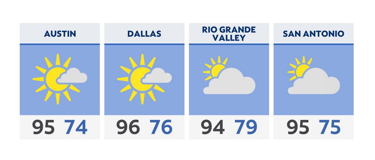
We can all take a collective sigh of relief this Wednesday, as rain chances have finally been erased from the forecast. Upper-level high pressure is now taking the reins, and will return us to a more typical July pattern featuring hot and humid afternoons.
Wednesday morning begins with low clouds and temperatures in the middle 70s for most. Cloud cover will dissipate completely by lunch time, revealing abundant sunshine.
High temperatures will climb into the 90s, but it will feel more like low 100s due to wet soil and a southerly flow in play.
Thursday’s forecast is nearly a carbon copy of Wednesday. Friday and the weekend may trend even hotter, with highs in the upper 90s.
We continue to keep a close eye on the tropics, as an area near Florida now has a medium (~40%) chance of development over the next couple of days. If a tropical system forms, it will move westward.
Click here for the latest 7 Day Forecast | Click here to share your weather photos