


A cold front will cross the region this evening and then stall, triggering showers and thunderstorms. A low-level severe threat exists, with isolated storms becoming strong to severe with gusty winds and heavy rain.
Overnight, a weather disturbance will ride along the stalled boundary, bringing another round of wet weather to the region. Although severe chances are much lower, any storm could contain heavy rain that leads to isolated flash flooding. Temperatures will be in the lower 70s.
With rain and a few thunderstorms during the morning hours, skies will stay mostly cloudy throughout the day. Temperatures will only manage the upper 70s to near 80 degrees tomorrow. An isolated afternoon storm is possible with the front in such close proximity, but no severe weather is expected.
Skies will stay mostly cloudy tomorrow night. Lows will be around 70.
We’ll end the workweek under mostly cloudy skies on Friday. A few afternoon thunderstorms will be possible but not widespread. Highs will be in the upper 80s. Drier conditions and heat return for the weekend.
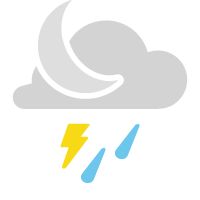 |
Scattered Thunderstorms Low: Low 70s; Winds: South-Southwest at 5 to 10 mph High: Near 80; Winds: Northeast at 5 to 10 mph |